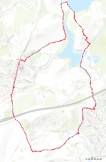
Barnt Green Waterways Circular Walk
This is a way marked route by Worcestershire County Council. Starting at Barnt Green (approx. postcode B45 8NW). It takes in some of the local countryside, walk towards Alvechurch, along a canal and past Upper Bittell Reservoir.
For public transport the Barnt Green railway station is nearby.
Distance: 5 miles

Click the map for a larger version


The route is also available through the Ordnance Survey Online OS Maps and as a GPX file for handheld sat nav systems.
- OS Map online route Barnt Green Waterways Circular Walk
- GPX file Barnt Green Waterways Circular Walk
Details of the route : Barnt Green Waterways Circular Walk (Worcestershire County Council).
